
Euroscope in Denmark
System Overview
Three profiles exist for Denmark:
1. COOPANS
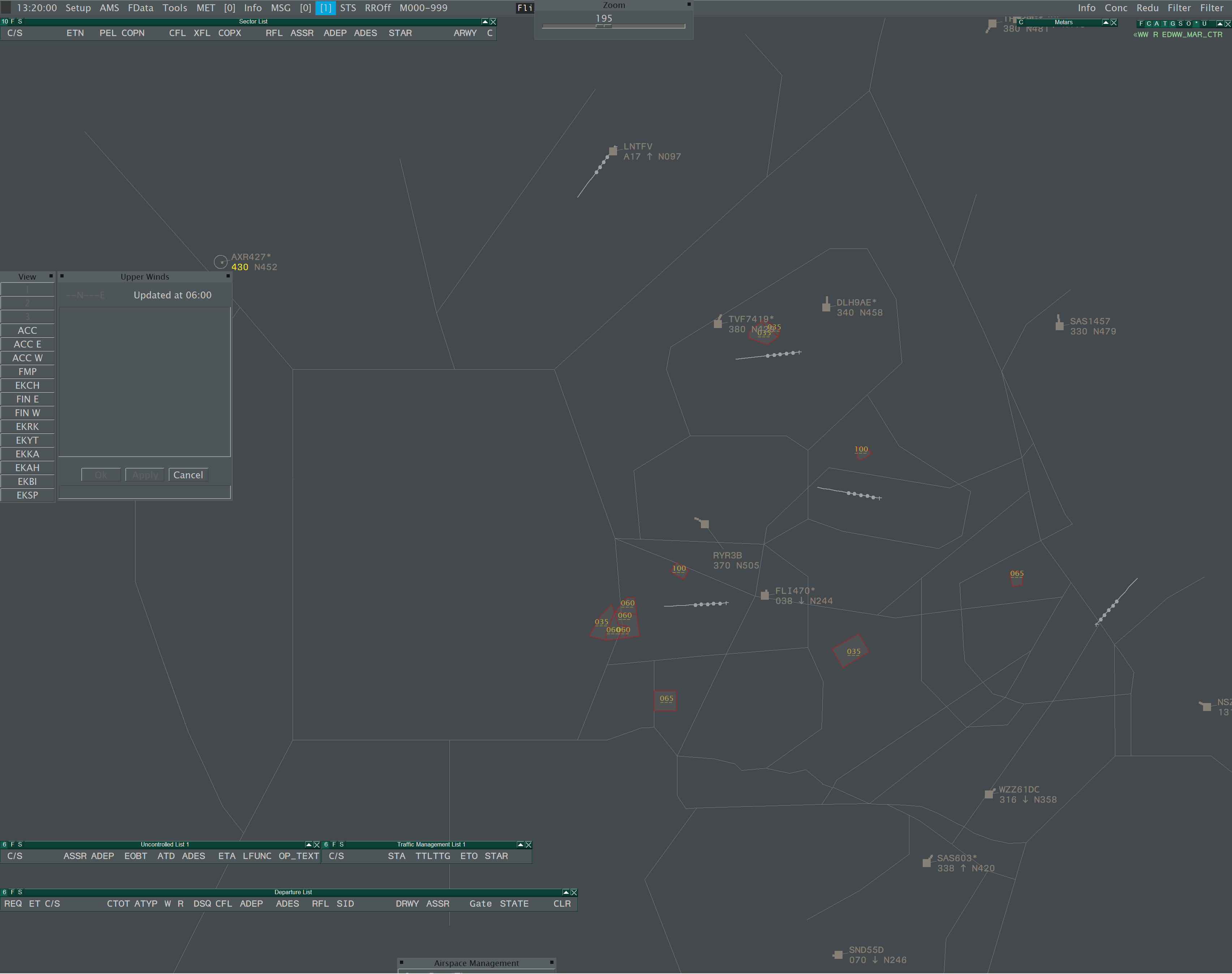
Used at EKCH APP, EKRK APP, EKBI APP and Copenhagen ACC.
Two Basic ASR configurations exist:
- 2_APP - Used by APP sectors, displays all LOW ACC and APP sectors and coastlines.
- 3_ACC - Used by ACC sectors, displays all HIGH+LOW ACC sectors and APP sectors. Coastlines are not drawn by default.
When controlling as Approach: upon connection to VATSIM, the radar display will automatically center and zoom on your area. Generally, no panning is required.
When controlling as ACC: upon connection to VATSIM, the radar display will center on the widest extent of your AOR. Use the VIEW menu on the left edge of the radar to focus on a certain area or TMA. It is recommended to switch to 2_APP momentarily when coastline display is required.
The amount of detail drawn within a TMA depends on whether the local APP is online, or topdown is in force, this is automatically configured.
2. NITOS
Used at EKCH TWR / APN, EKRK TWR and EKBI TWR. The only difference to COOPANS is the configuration of the flight lists.
3. RADIS
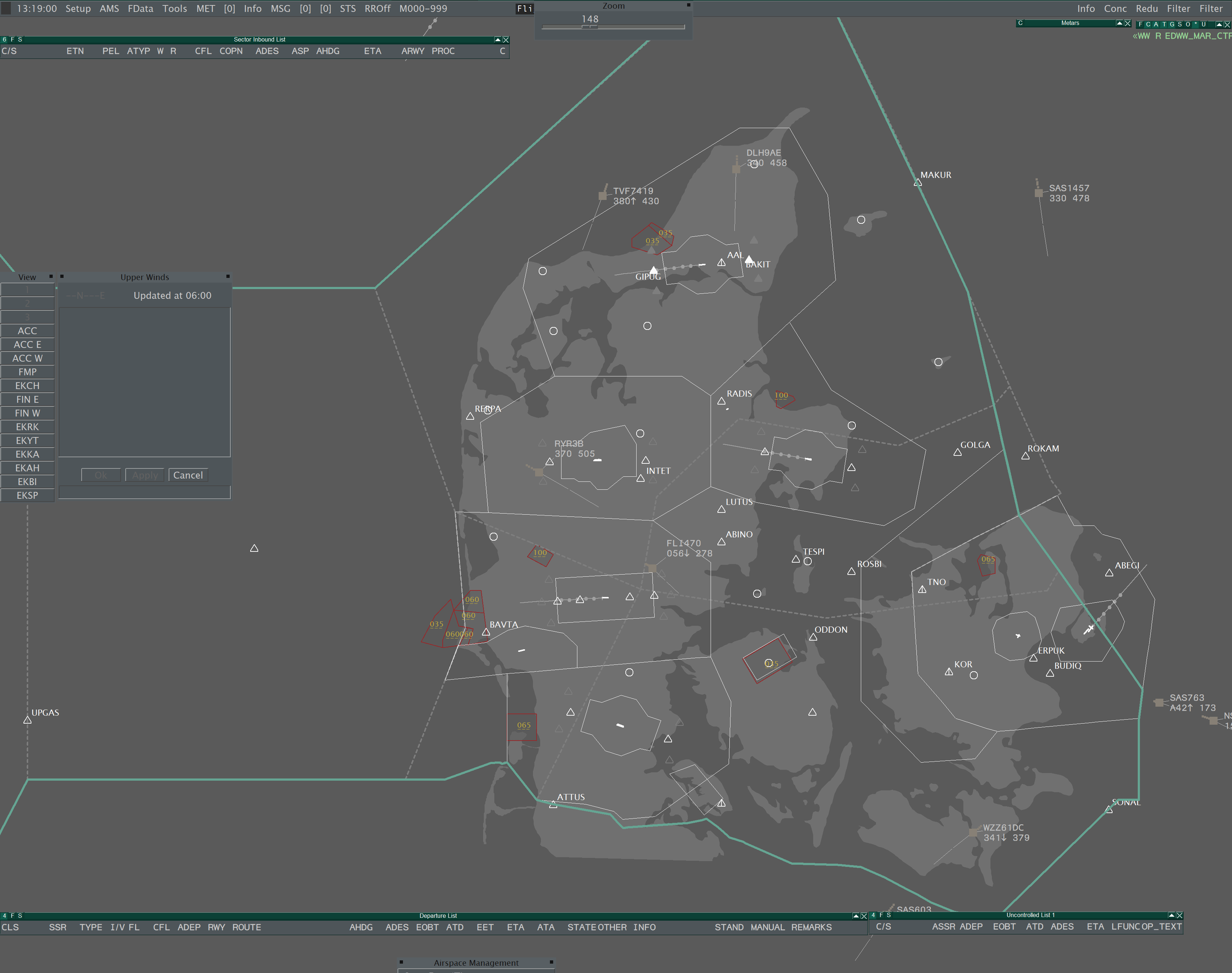
Used at EKSP, EKKA, EKYT, EKAH and in Greenland. Though the airfields are procedural, this profile should also be used in EKEB, EKVJ, EKOD, EKSB.
One ASR file pre-loads the RADIS configuration (1a_RADIS). Upon connection to VATSIM, the radar display will automatically center and zoom on your area.
RADIS is still in development, some features are not fully implemented. COOPANS may also be used to control APP in EKSP, EKKA, EKYT, EKAH.
ASR Shortcuts
ASR switching is only used to display ground layouts, or switch between COOPANS APP/ACC for example if coastline data is required as ACC, or to declutter in a zoomed out view as APP.
(F1+)
COOPANS / NITOS | RADIS |
|
|
in COOPANS: EKSP is only accessible via the OPEN ASR... function then selecting 3a_EKSP.ASR
Major airports are only drawn in their own ASR. Only procedural airports (EKSB, EKEB, EKVJ, EKOD & EKRN) share an ASR file. It is therefore not possible to have a single national ground view for all airfields.
Keyboard Shortcuts
Commonly used functions and reference maps are accessible via customised shortcuts:
(ALT+)
Functions:
S: Invoke SEP toolQ: Invoke QDM vectorF1: Opens new Notepad windowF4: Toggles quick lookF5: Toggles all prediction lines on/offF6: Opens runway approach line windowF7: Opens FPL selection windowF8: Opens SSR code menu for the find track functionF9: Opens create APL windowF10: Toggles filtering of uncoupled labelsF11: Opens small QNH/TL windowF12: Opens track control window (leader line settings)
Maps:
V: Toggles Regional IAF mapT: Toggles APP sector mapB: Toggles ACC sector map: Below FL285H: Toggles ACC sector map: Above FL285
Topsky Integration
All Danish profiles use TopSky plugin functions which replaces standard Euroscope behaviour.
1. Radar Maps (COOPANS & RADIS)
Relevant maps may be activated or deactivated using the Radar Menu > Maps Menu (ALT + RIGHT CLICK)
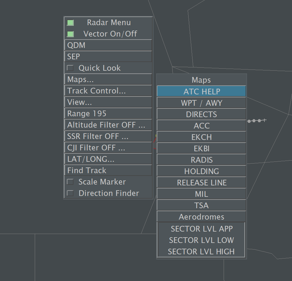
Maps are ordered by theme or applicable aerodrome. Most maps are conditional - they are activated when connecting to VATSIM as a specific unit/position.
-
LEFT CLICKto activate a map -
RIGHT CLICKto de-activate a map
Certain maps have a zoom visibility threshold and may be hidden if zoomed too far out/in
2. View Presets (COOPANS & RADIS)
A number of pre-defined view settings are available from the View Menu which is displayed on the left side of the main situation display, or accessed via the Radar Menu.
3. Track Leader Lines (COOPANS)
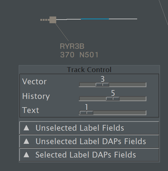
Track leader lines are drawn by topsky plugin, not Euroscope. They are set by default to:
- 2 minutes for ACC
- 1 minute for APP
- 0 minutes (off) for Observers / FMP
Their length may be customised in the Track Control Menu (ALT + F12)
RADIS leader lines are set using the Euroscope top menu function.