EKRK - Roskilde

Overview
Only 40 kilometers from the center of Copenhagen, Roskilde Airport (RKE) acts as a relief for Copenhagen Airport and is used by private aircraft, helicopters, flight schools, business, VIPs and the military. The airport also houses the Danish search and rescue services.
EKRK has approximately 60,000 operations (takeoffs and landings). each year.
ALWAYS remember, if you are unsure or in doubt then ask. We will always do our best to help you out!
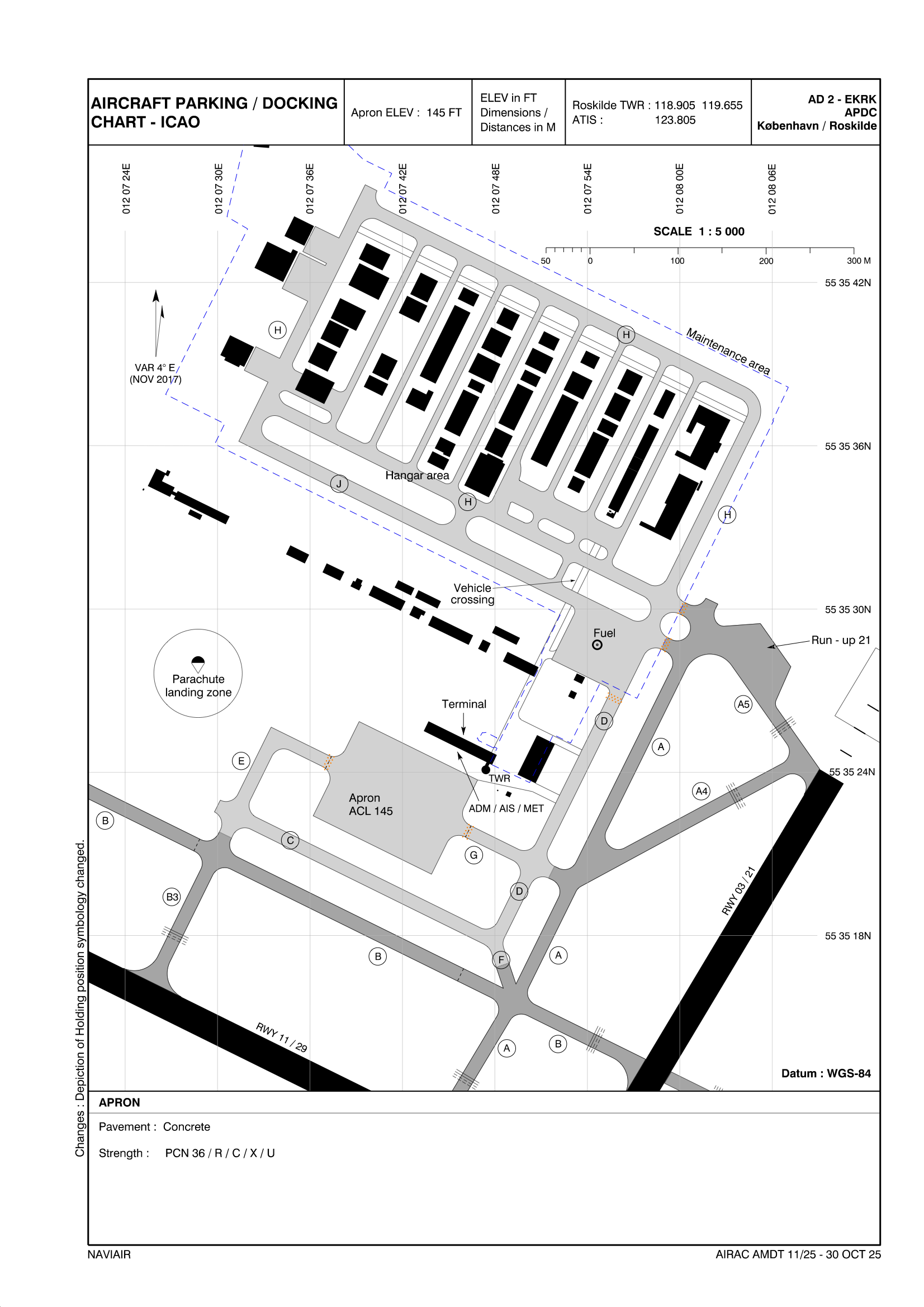
Use of stands
In Roskilde you can either park on APRON, or at the hangar area (see below)
PARKING CHART
IFR clearance
Initial contact is with Tower, reporting callsign, Position, and latest ATIS identification letter.
Remember to read/listen to the entire ATIS as there might be some specific info related to you!
As there are no SIDs in Roskilde your departure clearance will sound like this:
“Cleared to Destination via [Point]/[Flightplan route], Altxxx, expect level change, squawk 1234, After departure left/right turn toPOINT”
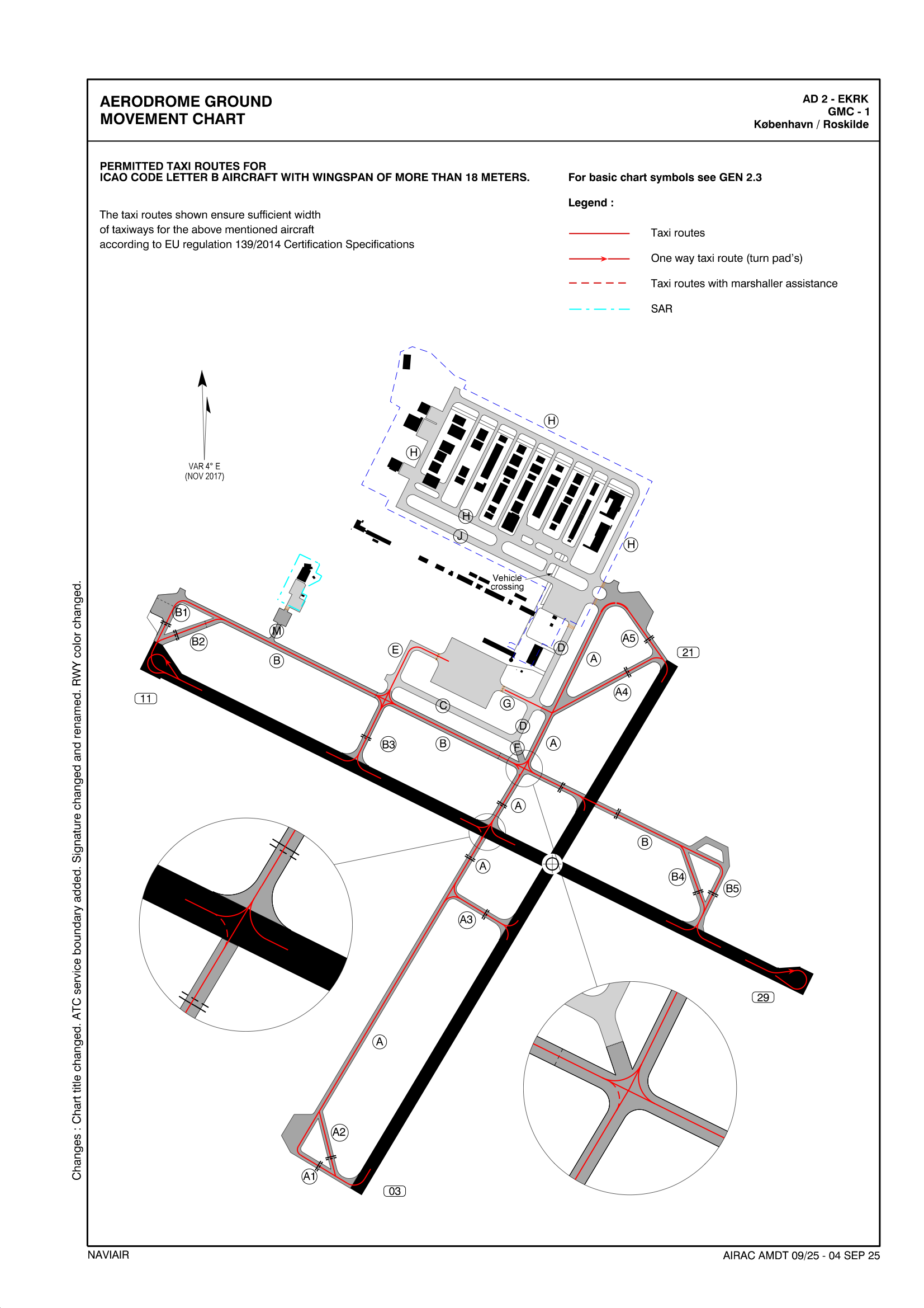
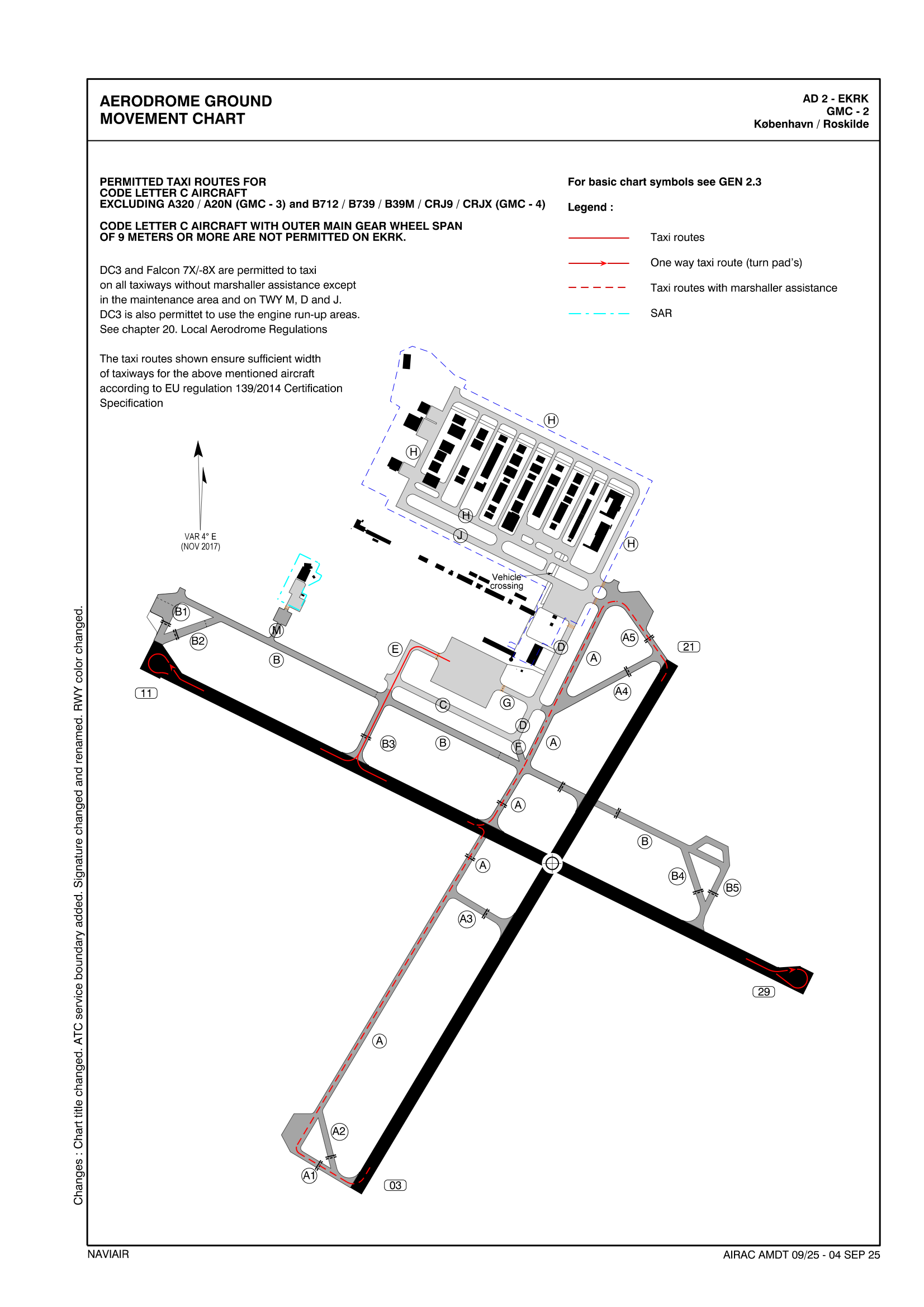
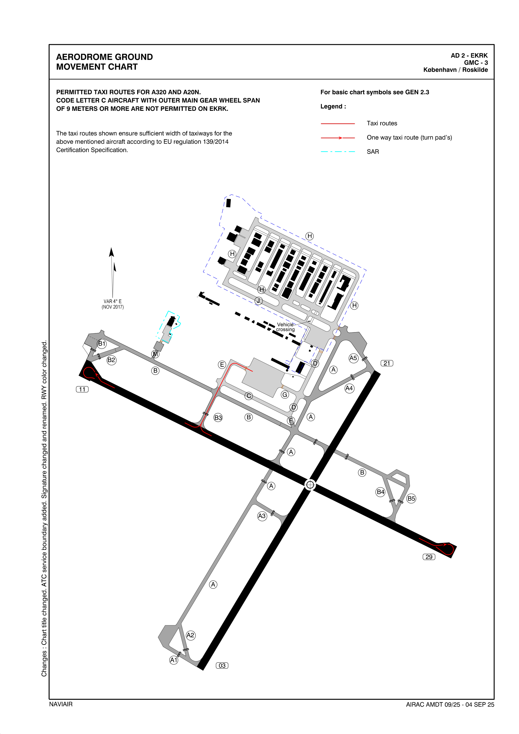
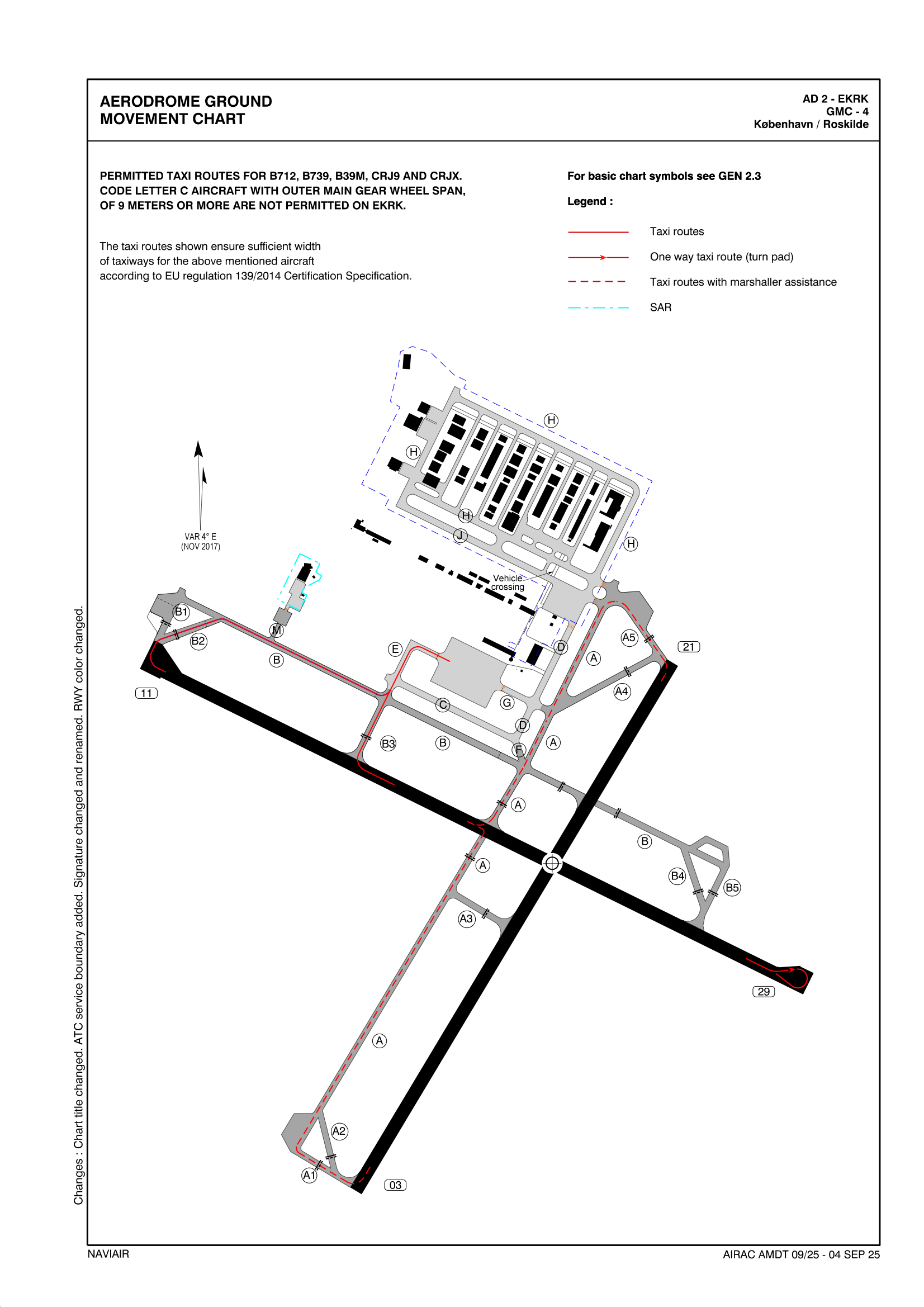
Taxi
There are different rules for taxiing in EKRK - see below for rules, regarding to wingspan and weight.
TAXI CHARTS
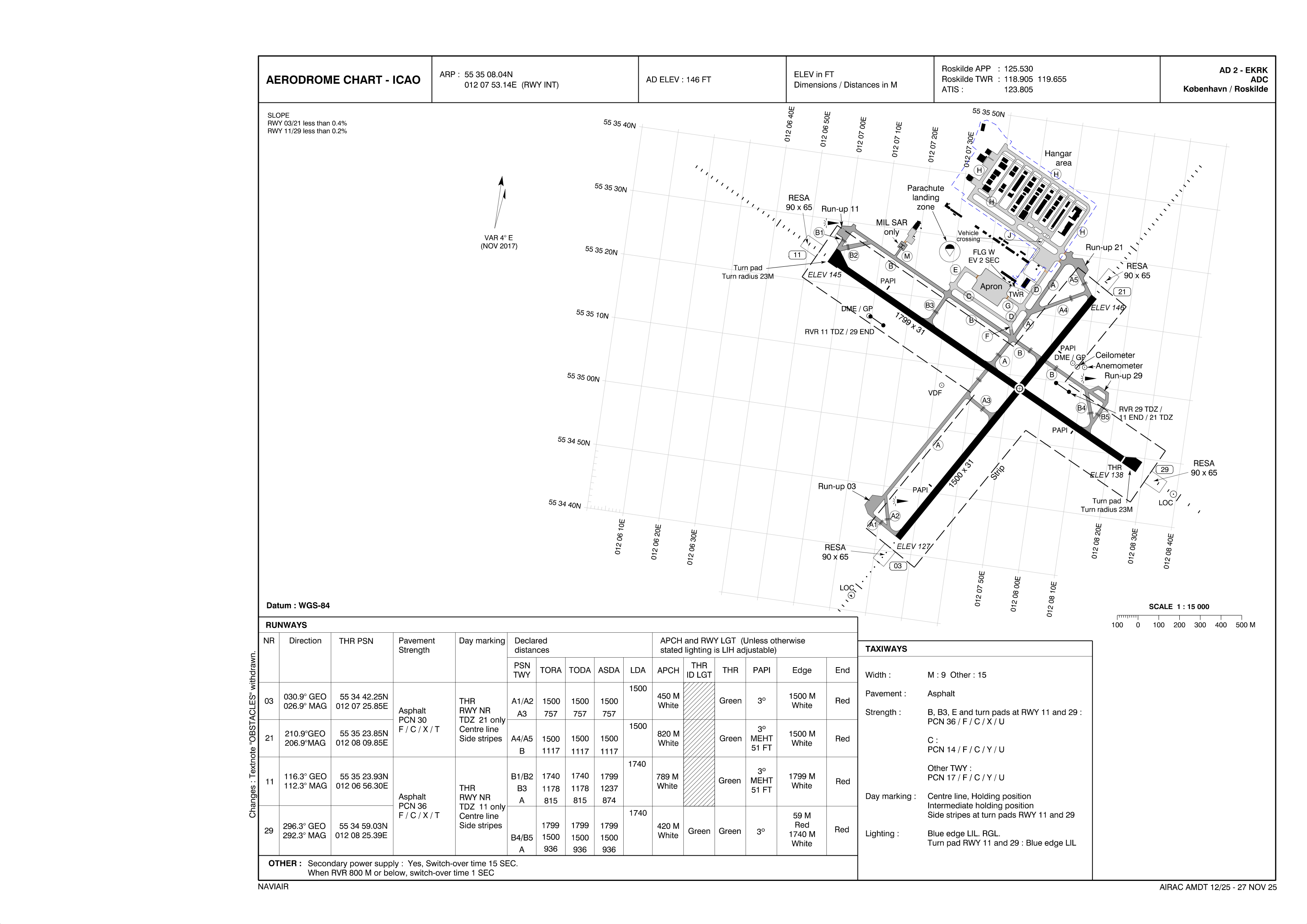
Runways
In Roskilde, there are 4 runways. Where as RWY 11 and 21 is the primary one used for IFR / medium traffic
RWY 03 and 29 is also used for VFR and Circuits.
AIRPORT CHART
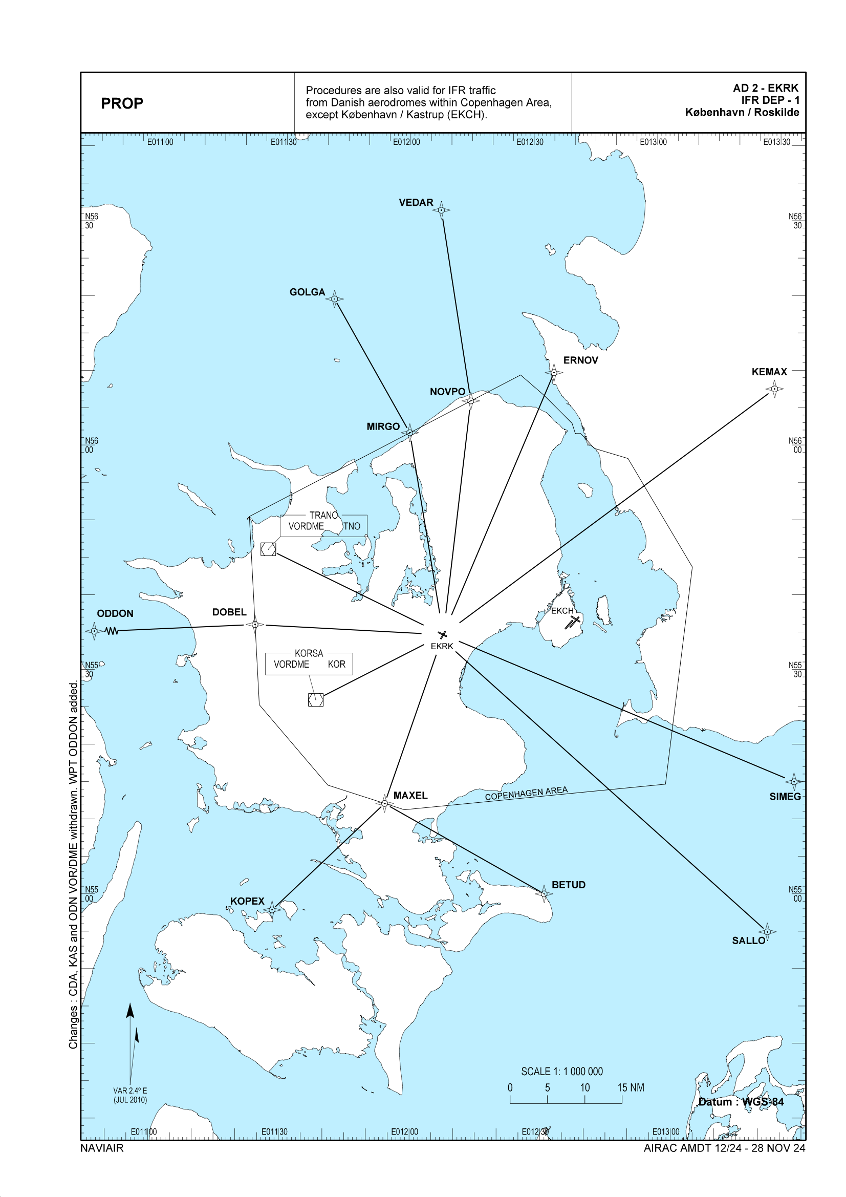
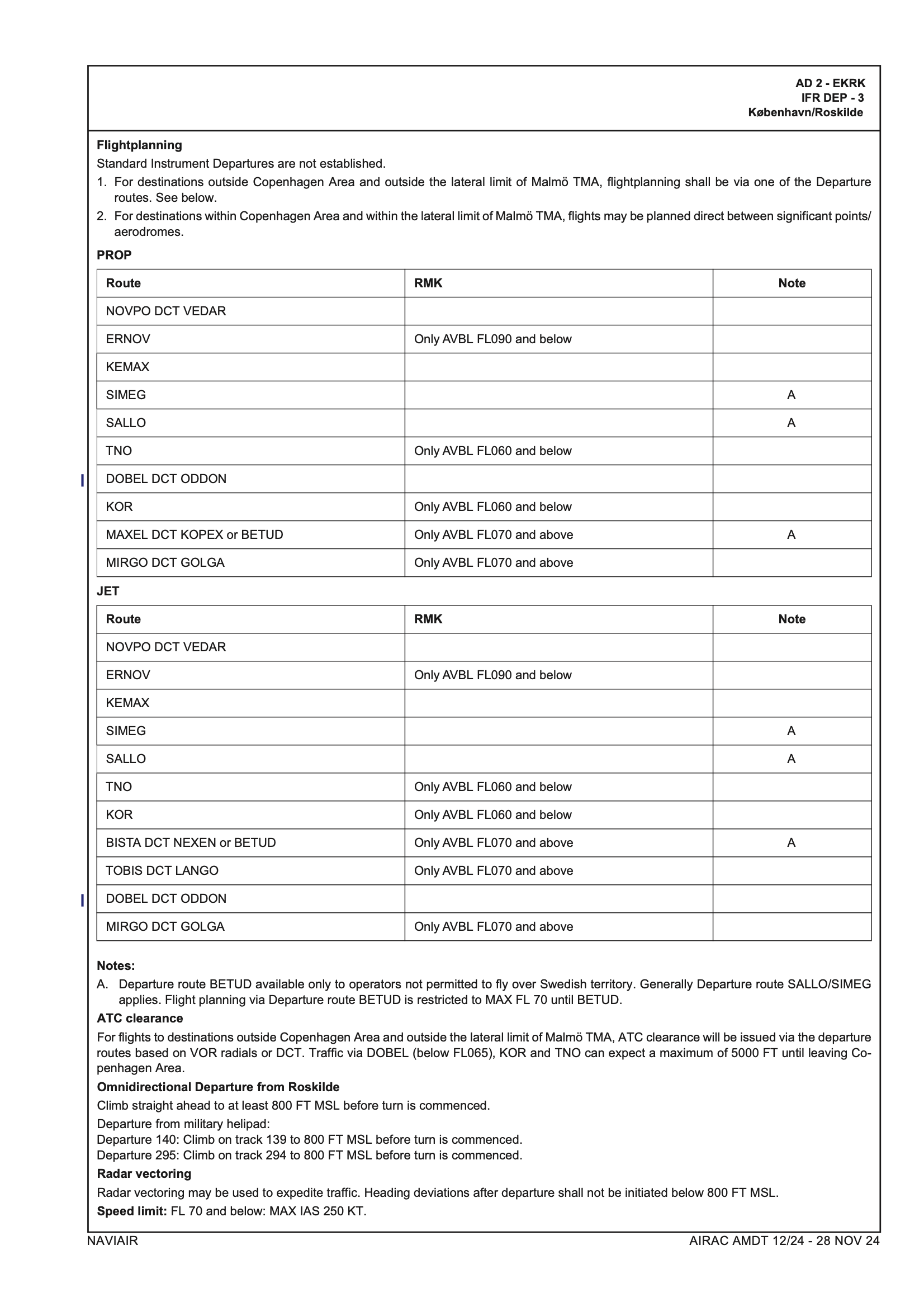
SIDs
There are no SIDs in Roskilde, hence you will always be cleared via WP / FP / DEP route.
There are though DEP routes, see below for charts.
DEPARTURE ROUTES
PROP
JET
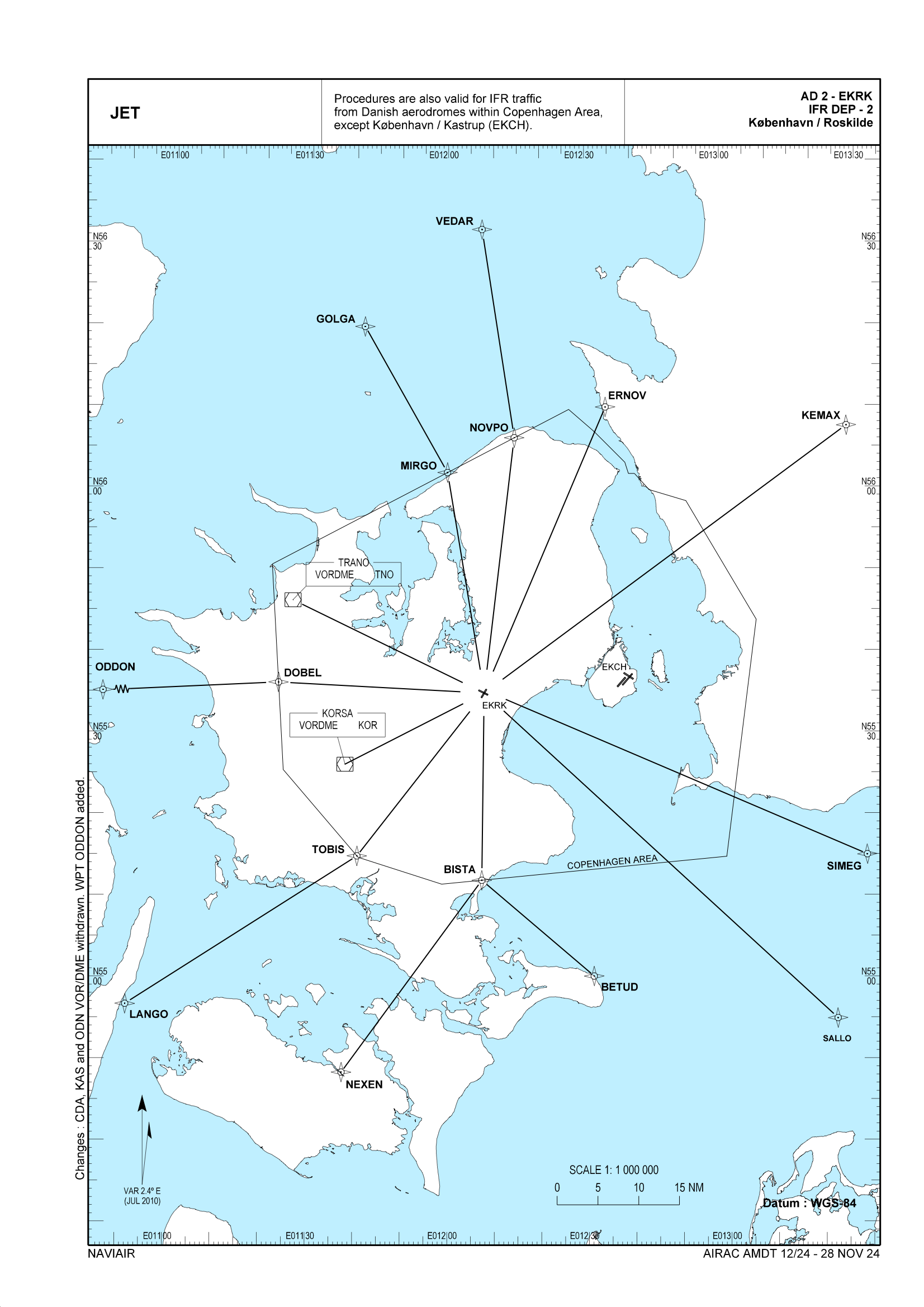
ROUTE DESCRIPTIONS
STARs
There are no STAR's in Roskilde.
Expect direct to ILS fix, waypoints or Vectors.
Approach
You might receive "Via [FIX] Cleared ILS/RNAV Runway XX" Meaning after that FIX you are cleared for the approach.
Visual Approaches can be approved for all A/C types on request to the APP controller.
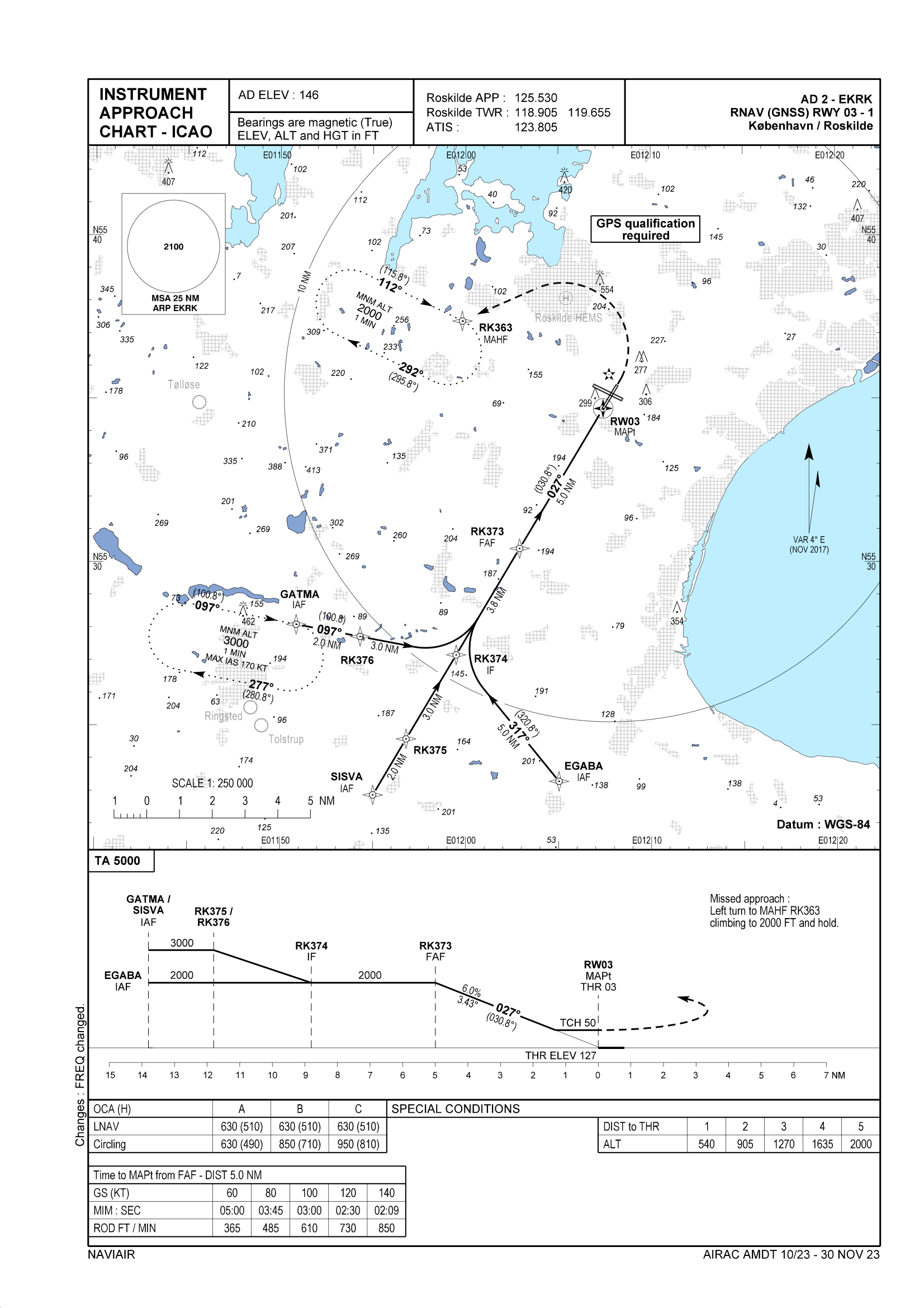
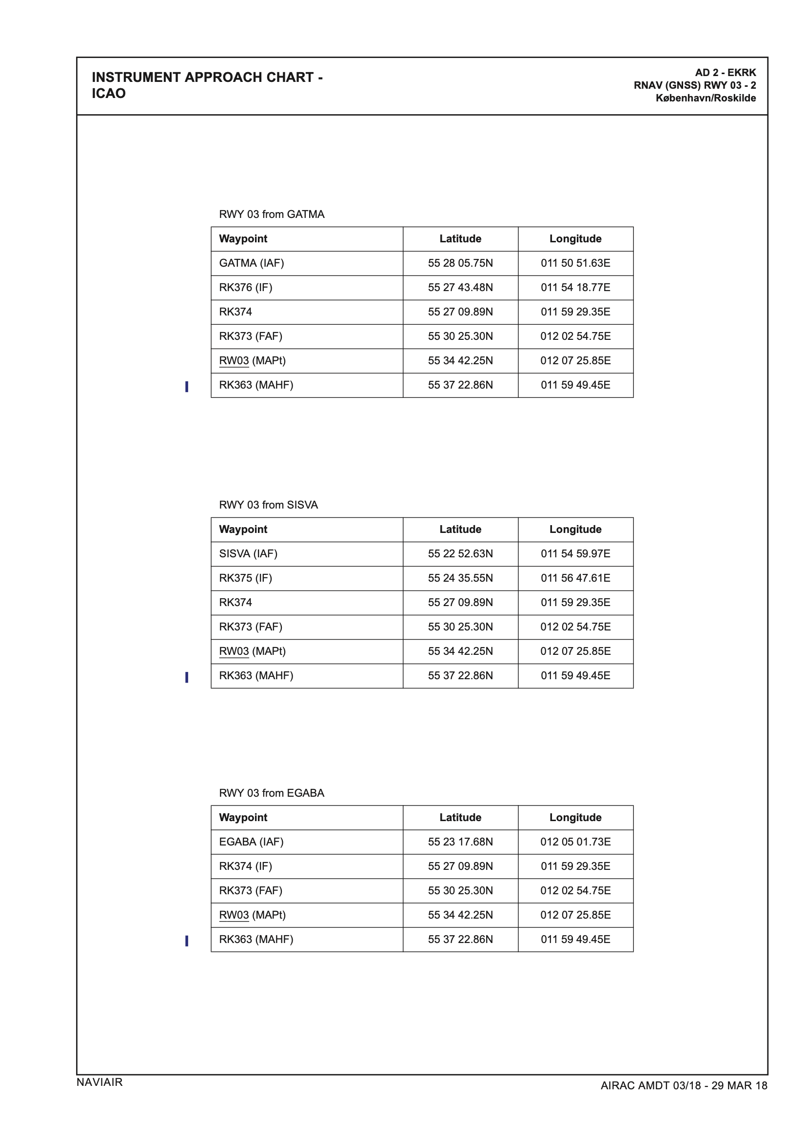
APPROACH CHARTS
RWY 03
RNAV (GNSS) RWY 03
RWY 11
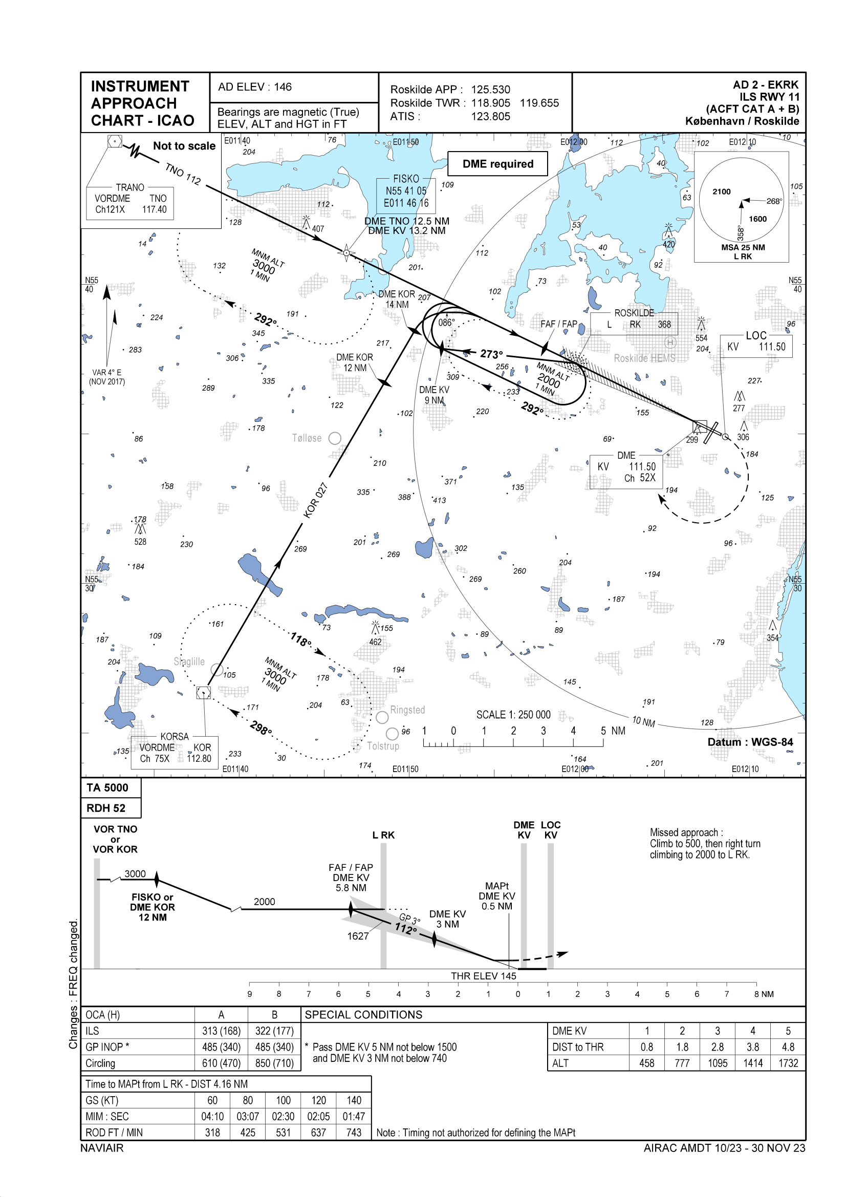
ILS RWY 11 (CAT A & B)
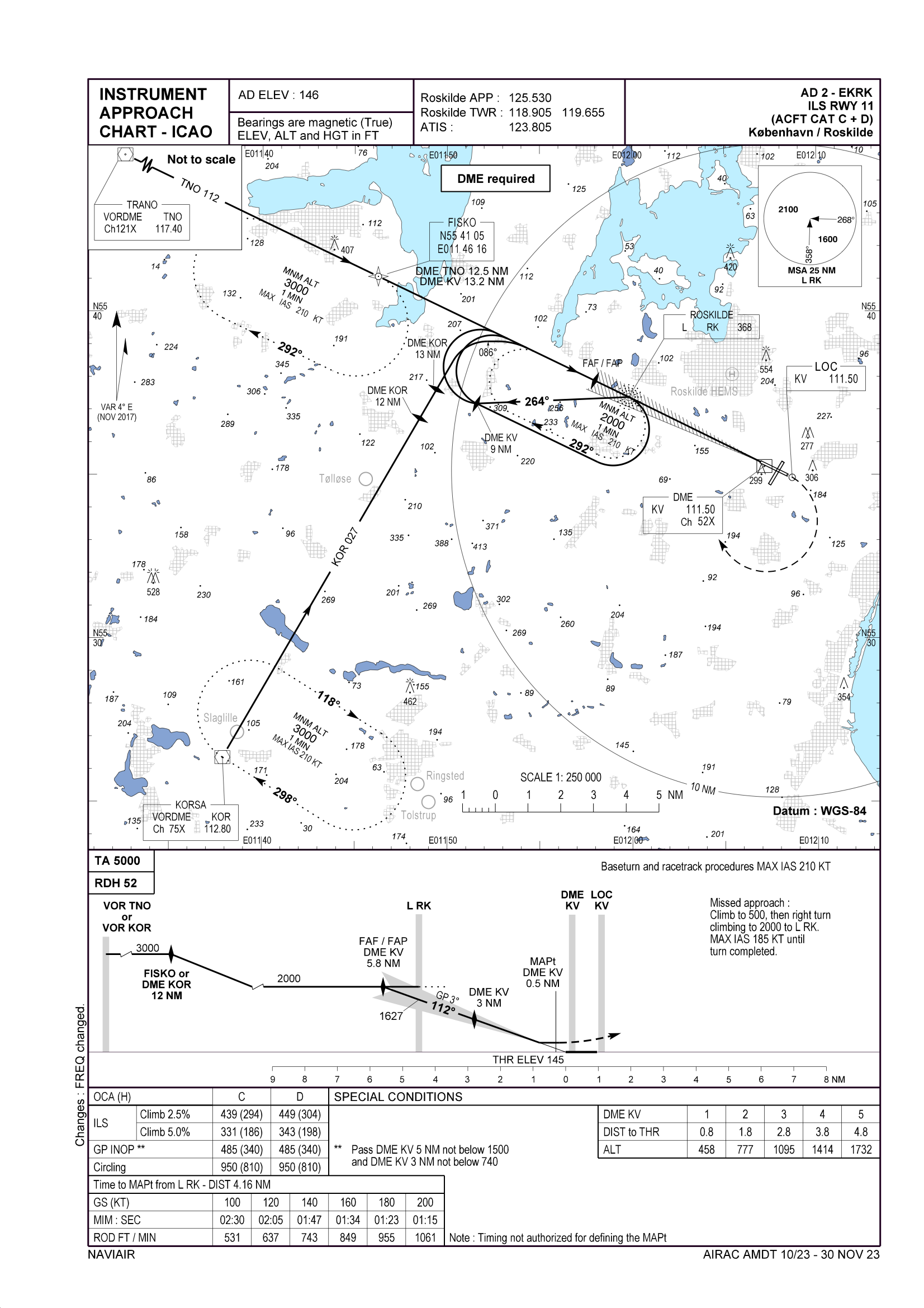
ILS RWY 11 (CAT C & D)
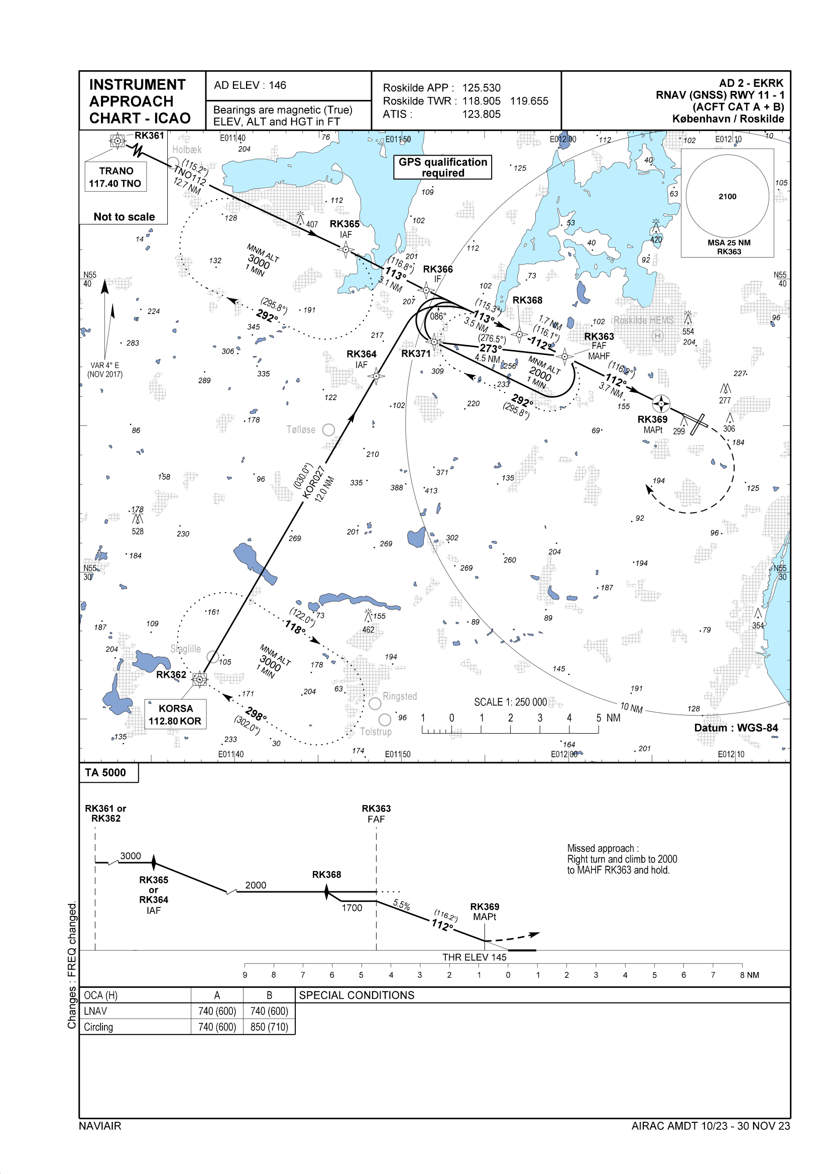
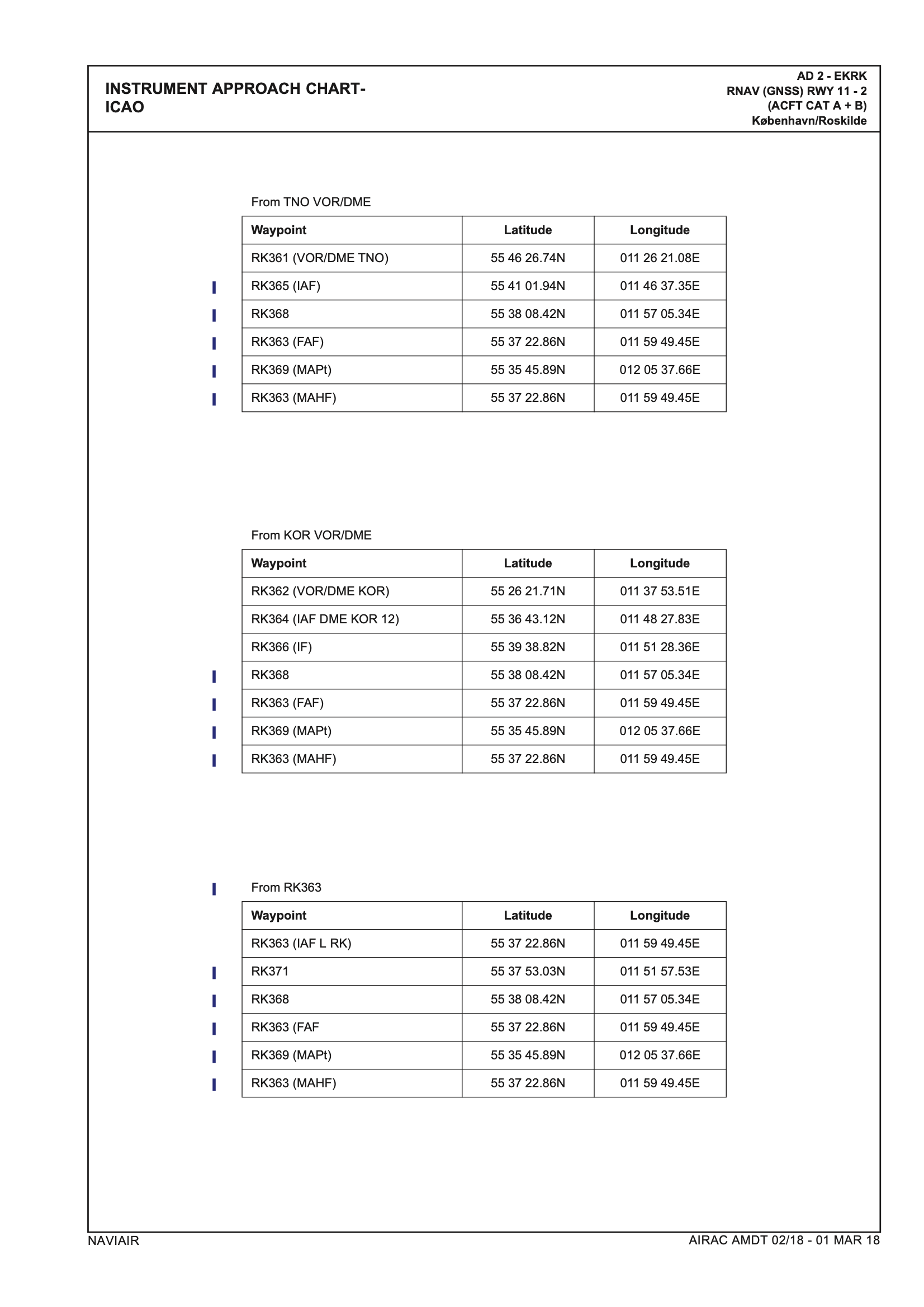
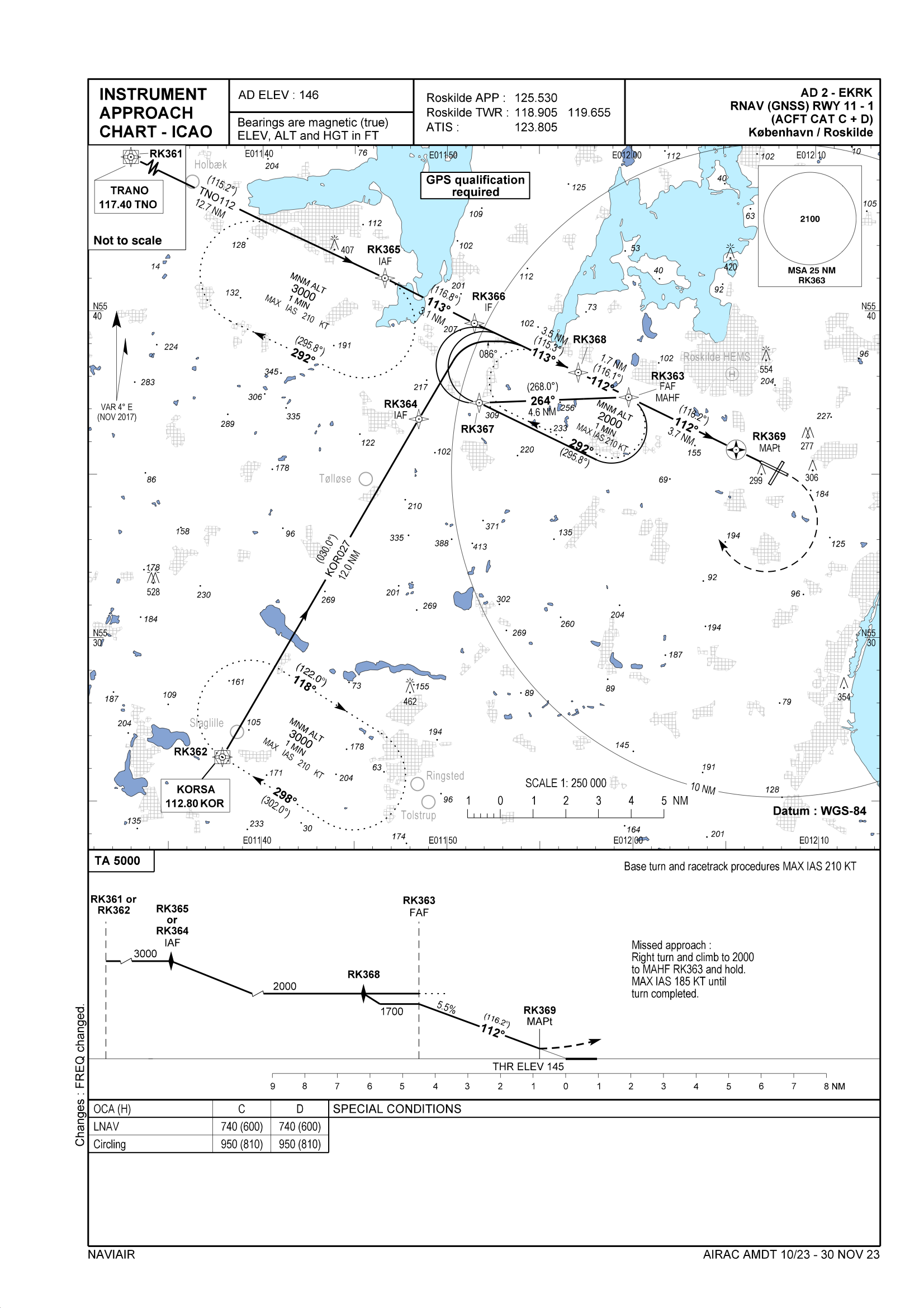
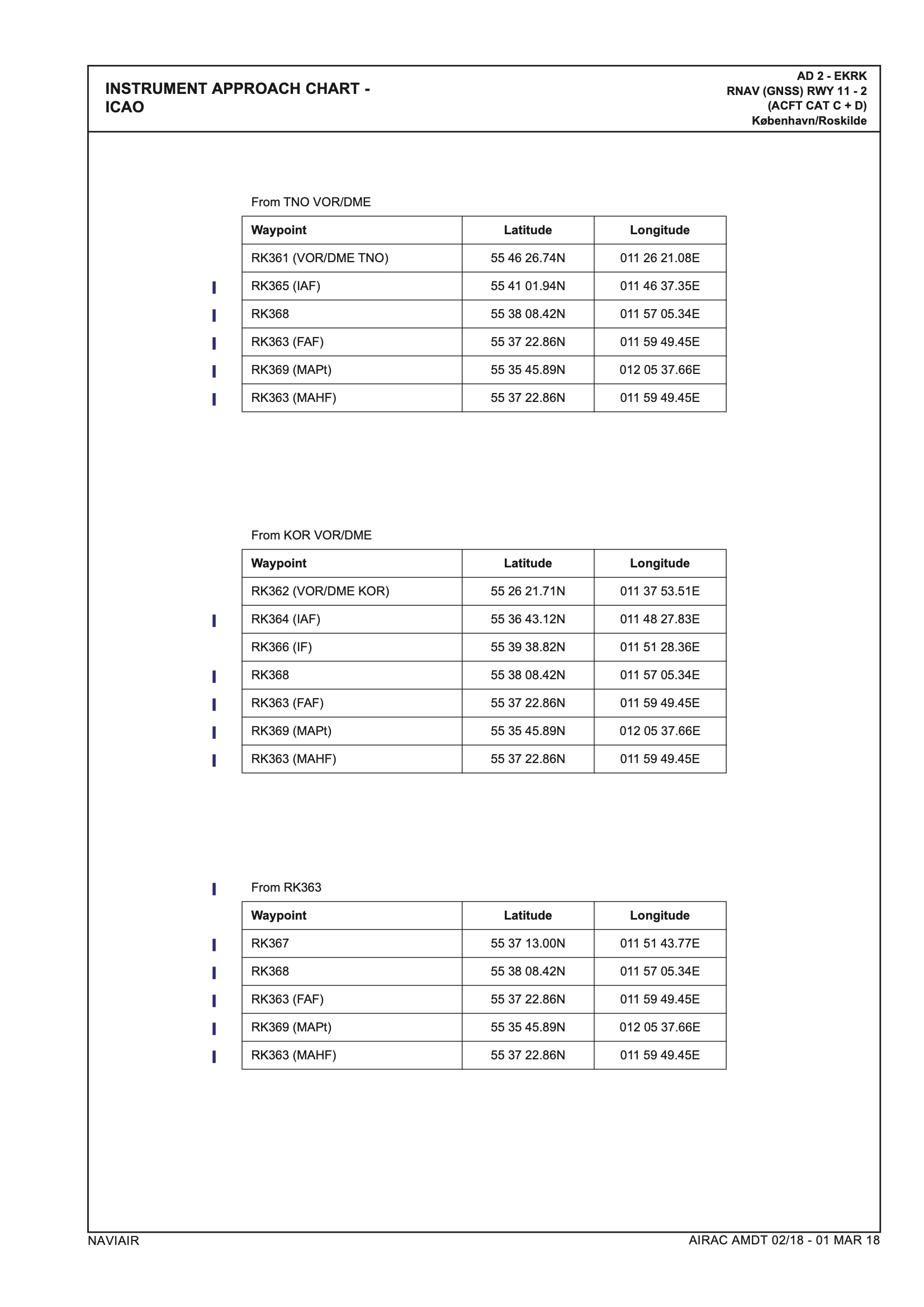
RNAV(GNSS) RWY 11 (CAT A & B)
RNAV(GNSS) RWY 11 (CAT C & D)
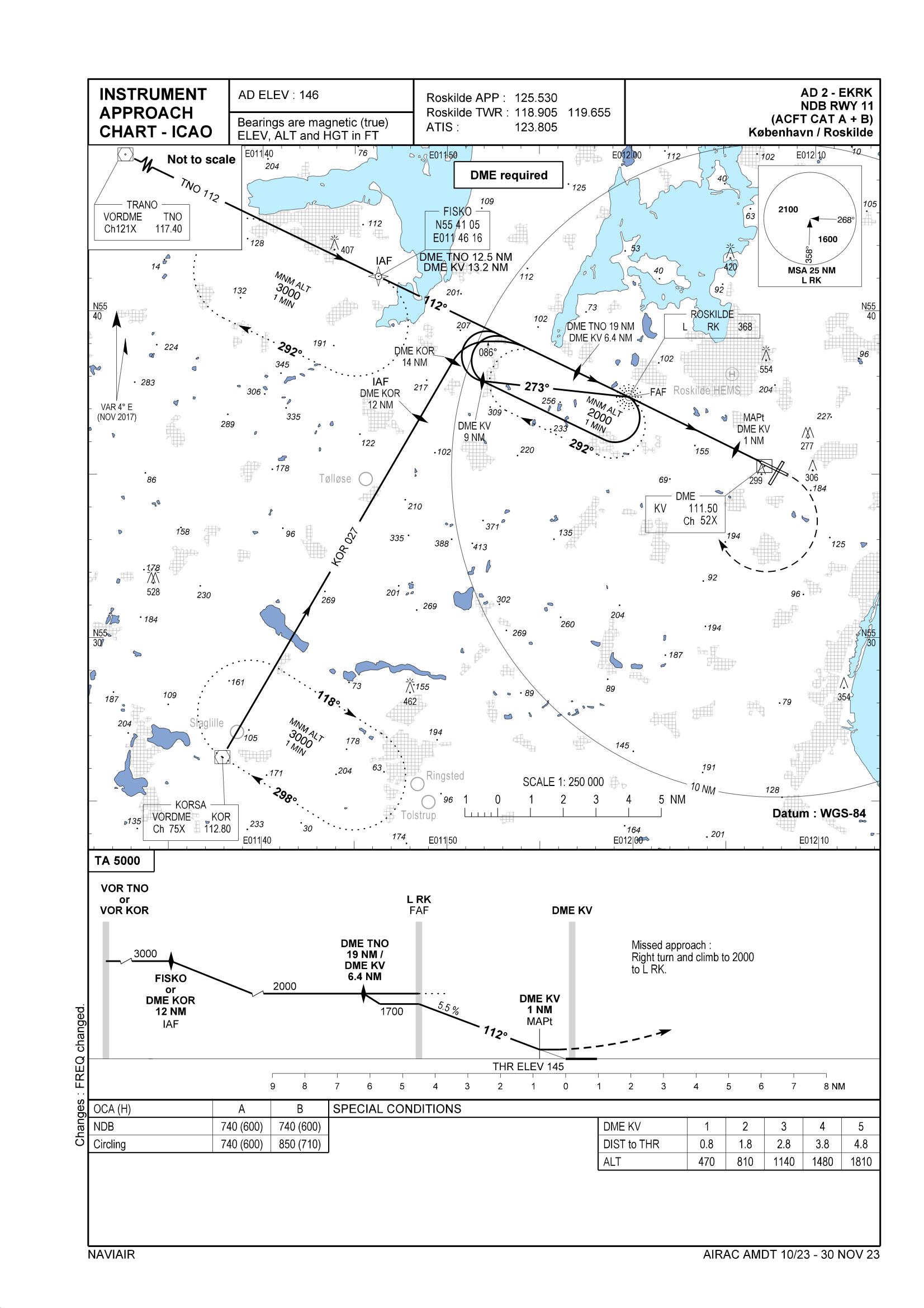
NDB RWY 11 ( CAT A & B)
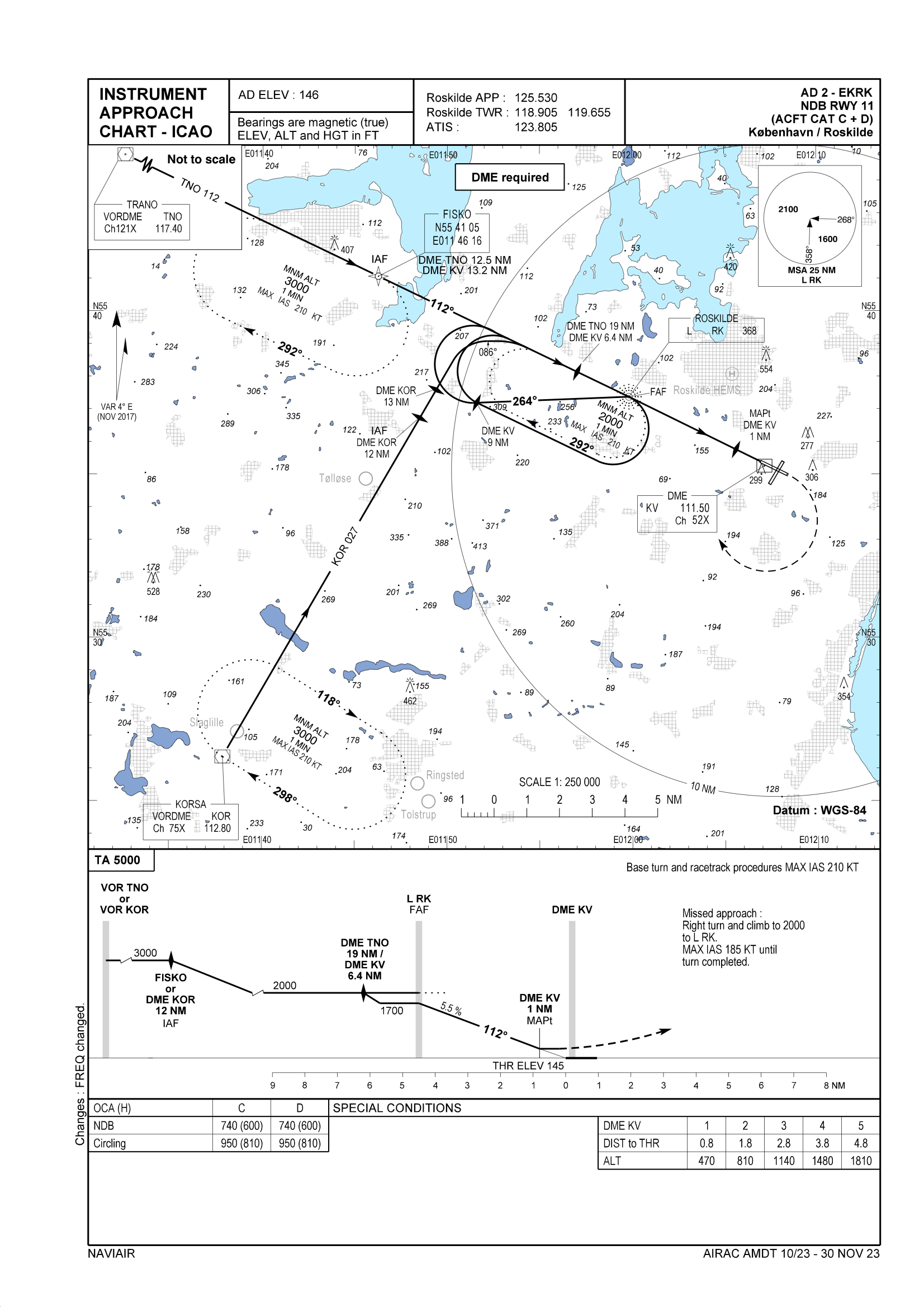
NDB RWY 11 ( CAT C & D)
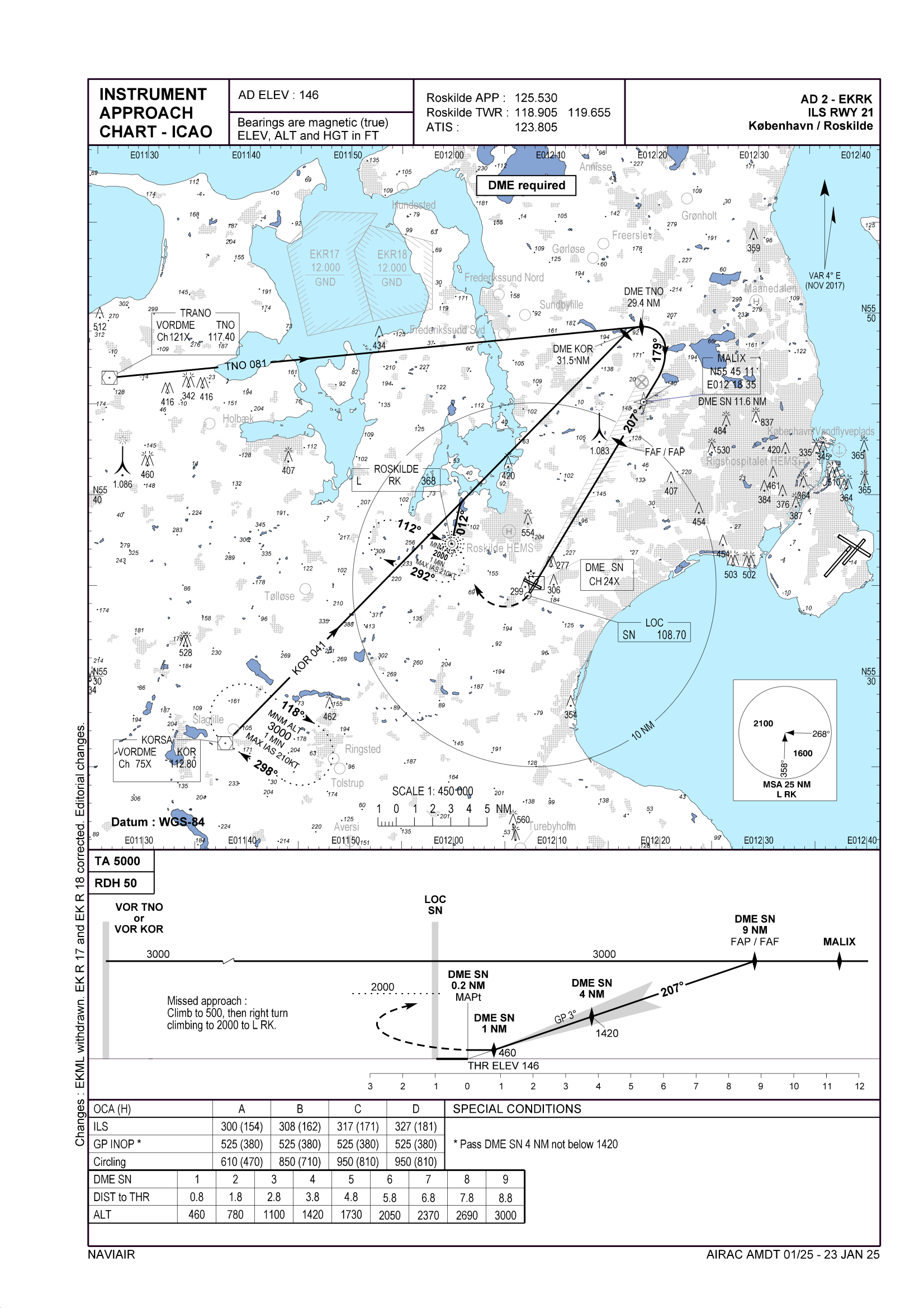
RWY 21
ILS RWY 21
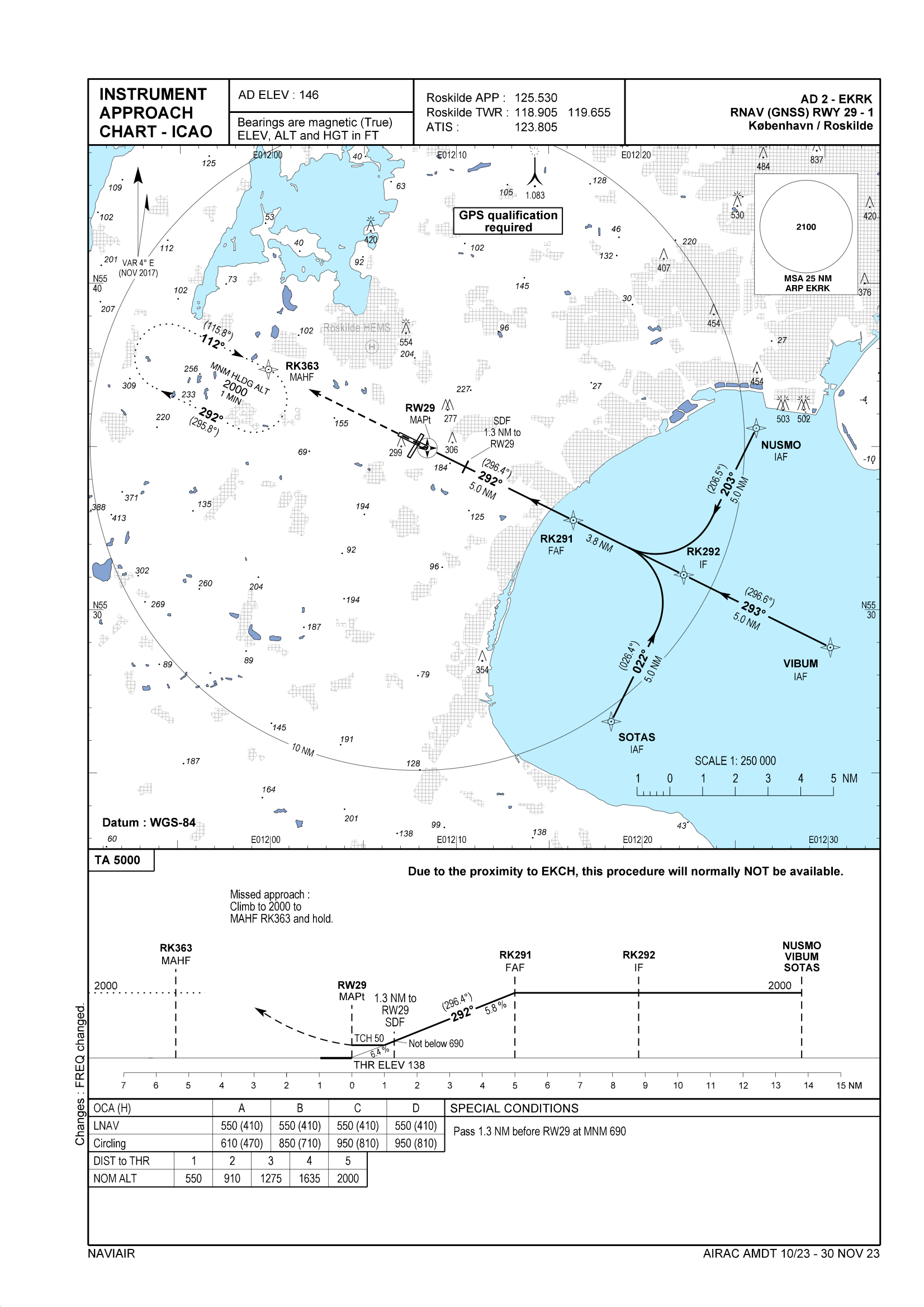
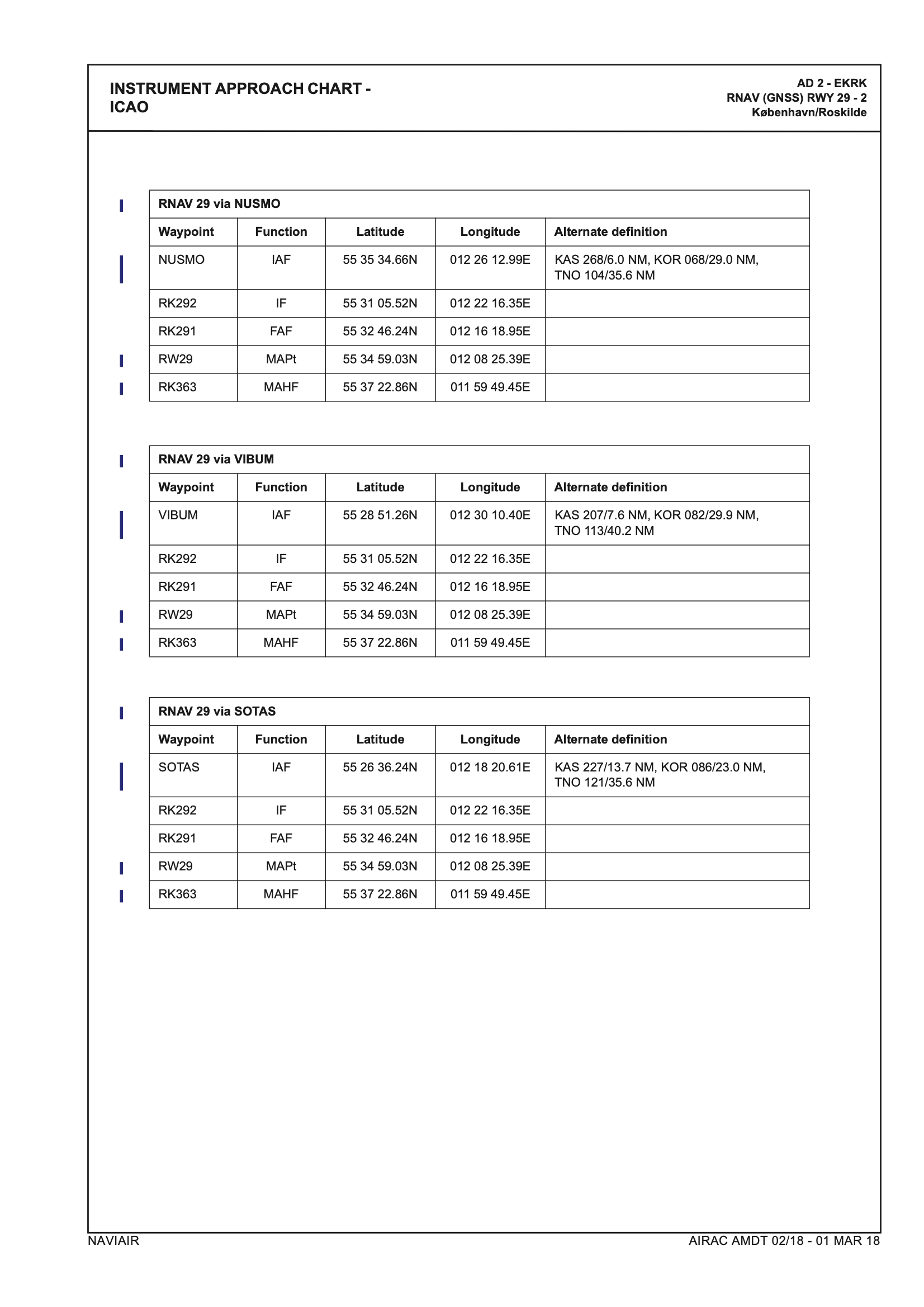
RWY 29
RNAV (GNSS) RWY 29
Direct routings
If traffic permits you might receive directs from both EKDK_CTR and APP.
The fixes normally given are the ones listed above.
VFR Procedures
VFR flights should enter controlzone via a reporting point, though not mandatory
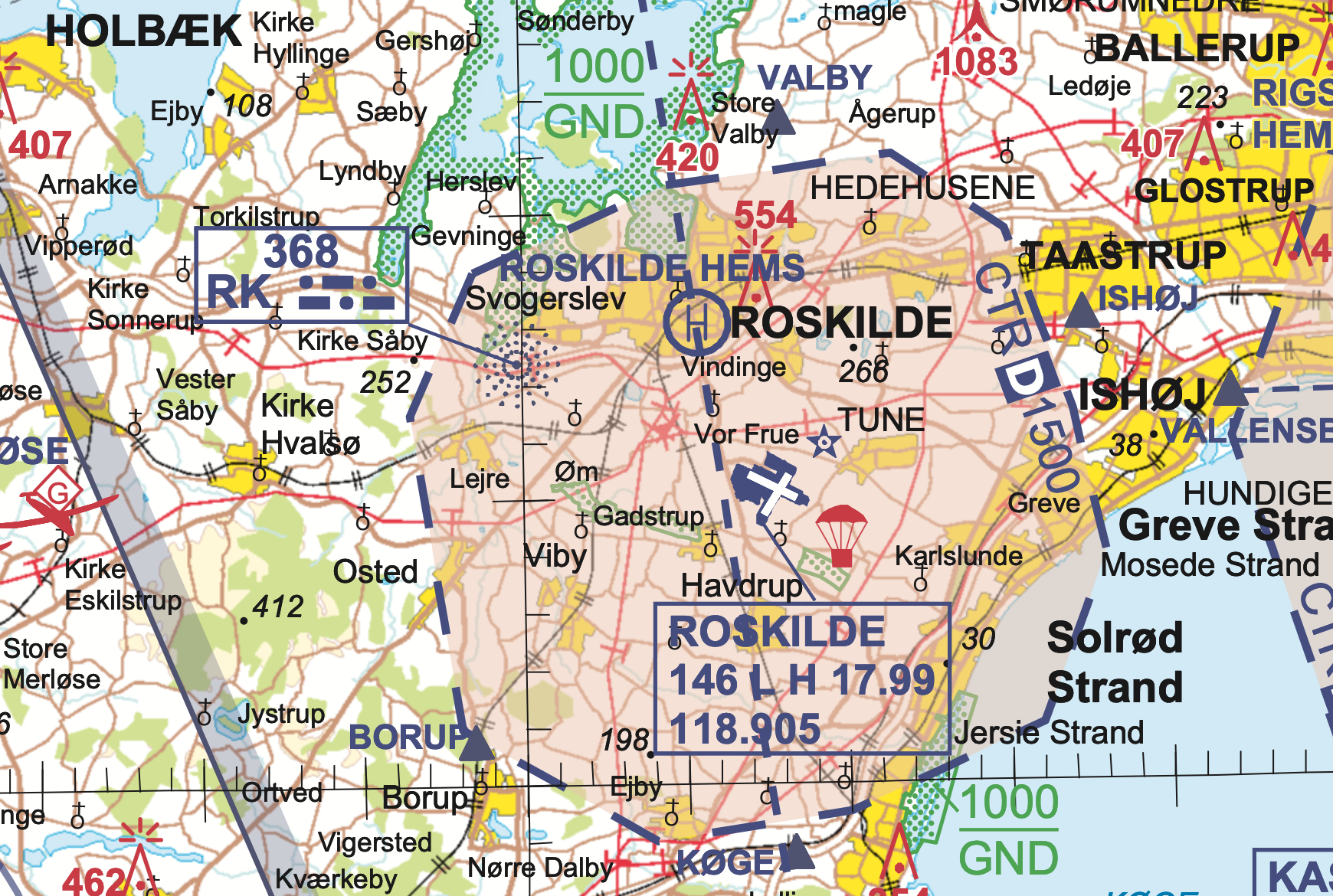
VFR chart of Copenhagen Area can be found here : VFR CHART
| Direction | Reporting Point | Runway 11 | Runway 29 | Runway 21 | Runway 03 |
|---|---|---|---|---|---|
| North | Valby | L. Base | R. Downwind | R. Base | L. Downwind |
| East | Ishøj | L. Downwind | R. Base | L. Base | R. Downwind |
| South | Køge | R. Downwind | L. Base | L. Downwind | R. Base |
| Southwest | Borup | R. Base | L. Downwind | R. Downwind | L. Base |
- Either runway may be used for VFR traffic, however Runway 11 or Runway 21 should be prefered as long as tailwind is less than 5 knots on either runway
- A unique squawk is not required for EKRK controlzone, but is still recommended, especially if controlling topdown coverage.